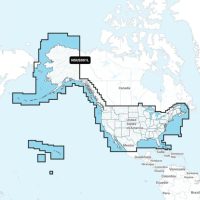

Navionics+ Maps for Garmin Chartplotters
Navionics+ Charts and Maps for Garmin Chartplotters
Garmin is a trusted leader in marine navigation, providing customers world-wide with cutting-edge mapping solutions that are designed to enhance boating and fishing experiences. Arguably the best in precision navigation, Garmin marine charts and Navionics maps offer access to highly detailed navigational data tailored for seamless integration with Garmin chartplotters. These maps not only improve situational awareness on the water but also help to ensure safety, efficiency, and ease of use. Whether your vessel spends more time out on the open seas or anchored in an inland lake, Garmin navigation charts are an exceptional (and essential) tool for real-time updates and accuracy.
(more...)Key Features of Garmin Marine Charts
Comprehensive Coverage
Whether your next marine adventure is in coastal or inland waters, Garmin charts provide extensive coverage to ensure boaters have up-to-date maps for their region. This means that you can plan to sail the Atlantic coastline, navigate any of the Great Lakes, or fish in your favourite remote waterways, all using Garmin GPS charts for accurate and reliable mapping data. Additionally, these maps enable precise routine planning and hazard avoidance using detailed bathymetric contours and navigational aids.
High-Resolution Relief Shading
A key feature of Garmin navionics is high-resolution relief shading, which is a unique characteristic that enhances underwater visibility by offering a more detailed and realistic view of seabed and lakebed formations. This is a particularly useful detail for anglers and divers, as it allows them to locate underwater formations, wrecks, and potential fishing hotspots with greater clarity.
Daily Updates for Real-Time Accuracy
Garmin navigation charts receive regular updates, offering users access to the most recent navigational data. These updates include new chart content, revised depth contours, and important safety notices, which help boats to remain informed about potential hazards and changing water conditions. Garmin GPS charts provide this up-to-date information, promoting safer navigation.
Advanced Auto Guidance+™ Technology
Garmin maps are equipped with Auto Guidance+™, an advanced autorouting technology that calculates the best routes based on chart data, water depths, and known obstacles. This technology helps boaters plan efficient routes through marinas, inlets, and narrow channels, reducing their chances of running aground.
Benefits of Using Garmin Navionics Charts and Maps
Enhanced Navigation Safety
Garmin charts provide detailed depth contours, hazard markers, and navigational aids that contribute to safer marine travel. By offering real-time updates and precise topographical information, these maps help prevent potential accidents and ensure that boaters choose safer navigational paths.
Improved Fishing Experience
For anglers, Garmin marine charts are an invaluable tool that offers detailed underwater topography to help identify structures where fish may congregate. This feature makes it easier for them to target better fishing areas. Plus, with Garmin navionics, users can access key information such as submerged vegetation, drop-offs, and depth variations to maximize their fishing success.
User-Friendly Interface and Seamless Integration
Garmin navigation charts are designed for intuitive use, seamlessly integrating with Garmin chartplotters. With clear menus, easy zoom functionality, and touch-screen compatibility, these maps provide effortless navigation and endless data. Plus, they make it easy to plot routes, mark waypoints, and customize the display for a more personalized boating experience.
Product Selection Guide
Compatibility Check
Before purchasing Garmin maps, it’s important to verify that they are compatible with your specific Garmin chartplotter model. While most modern Garmin devices support Navionics charts, checking compatibility ensures that you get the most accurate and detailed maps for your device.
Regional Map Options
Selecting the right regional map is a crucial part of your boating experience. Garmin charts Canada provides comprehensive mapping for Canadian waters, including major lakes, rivers, and coastal regions.
Access to high-quality Garmin maps and accessories is easy when you shop at Poco Marine! Whether you’re looking for Garmin charts Canada, detailed fishing maps, or advanced navigation tools, we have a selection of products featuring top-tier solutions for confident guidance on the water. After all, investing in Garmin navionics ensures safety and precision for boaters. Browse our collection today.
FAQs on Garmin Electronic Charts
- How often are Garmin Navionics+ maps updated?
Garmin navigation charts receive daily updates to ensure that all users have access to the latest chart data, depth adjustments, and navigational aids. To improve mapping accuracy, you do need to subscribe to Garmin’s update service. - Can I use these maps on multiple Garmin devices?
Garmin GPS charts are typically licensed for use on a single device. However, some Garmin products allow for map sharing. Be sure to check the specifications of your model before purchasing if this is a desired feature. - What is the process for updating my maps?
Updating Garmin marine charts is simple and can be done via Garmin Express software. When you connect our device to a computer, you can access the update service, which allows you to download the latest map enhancements and charts.
Showing all 12 results
-
Sale!

Garmin Bluechart G3, VCA018R, MicroSD/SD Card-Inside-Outside Passage
Original price was: $ 449.95 CAD.$ 349.95 CADCurrent price is: $ 349.95 CAD. Add to cart -
Garmin HXCA600X BlueChart G3 MicroSD/SD Map Card-Canada
$ 289.95 CAD Add to cart -
Garmin HXUS604X Bluechart G3 MicroS/S Card US All & Canadian West Coast
$ 289.95 CAD Add to cart -
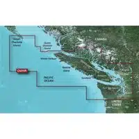
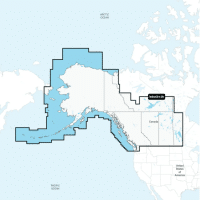
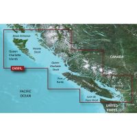
Garmin Navionics Vision+ Canada West & Alaska – Lakes, Rivers and Coastal Marine Charts
$ 299.99 CAD Add to cart -
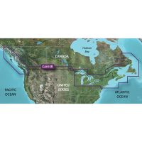
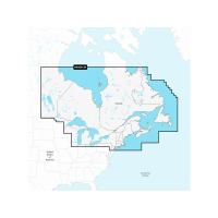
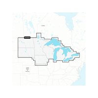
Garmin Navionics+ Canada East & Great Lakes – Lakes, Rivers and Coastal Marine Charts
$ 199.95 CAD Add to cart -
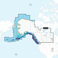
Garmin Navionics+ Canada North – Lakes, Rivers and Coastal Marine Charts
$ 259.95 CAD Add to cart -
Garmin Navionics+ Canada West & Alaska – Lakes, Rivers and Coastal Marine Charts
$ 189.95 CAD Add to cart -
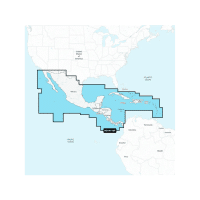
Garmin Navionics+ Central America & Caribbean – Inland and Coastal Marine Charts
$ 199.95 CAD Add to cart -
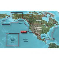
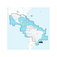
Garmin Navionics+ Mexico, Caribbean to Brazil – Inland and Coastal Marine Charts
$ 259.95 CAD Add to cart -
Sale!
Garmin Navionics+ U.S. & Coastal Canada – Lakes, Rivers and Coastal Marine Charts
Original price was: $ 259.95 CAD.$ 199.95 CADCurrent price is: $ 199.95 CAD. Add to cart -
Garmin Navionics+ U.S. North & Great Lakes – Lakes, Rivers and Coastal Marine Charts
$ 199.95 CAD Add to cart -
Garmin VCA501L Bluechart G3 Vision MicroS/SD Card-Puget Sound-Dixon Entrance
$ 469.95 CAD Add to cart